Purpose
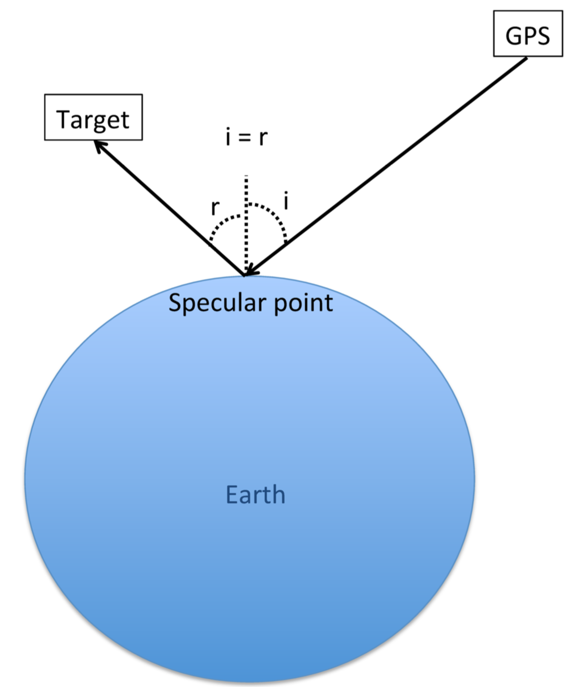
Definition of a specular point
A specular point is the location on the surface of the Earth of the reflection of a signal sent by one satellite to a target satellite, as shown in Figure 1. As a remote sensing technique, this can be used to calculate sea surface heights, ionospheric total electron content, or the root mean squared slope of the ocean that can then be related to the surface wind speed, as used on the CYGNSS mission.
(Bussy-Virat et al., 2018(a)).
Measuring wind speeds...
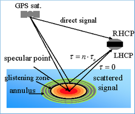
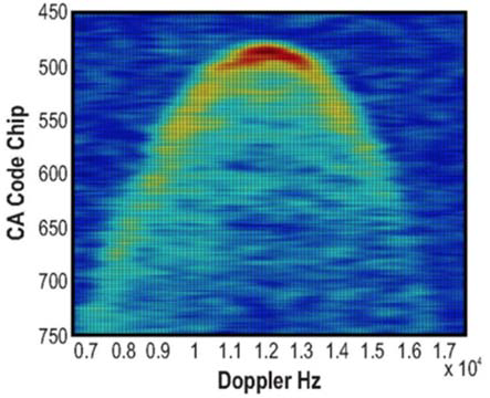
Figure 2a shows the geometry of a GPS signal scattered off the ocean surface and reflected to the CYGNSS left-hand circular polarization (LHCP) antenna. The strength of the reflected signal contains information about the roughness of the ocean as a function of delay and Doppler, that can then be related to the wind speed around the specular point. An example of a Delay Doppler Map (DDM) is given in Figure 2b. Typically, the winds over the ocean do not have much structure over scales of 25-100 km, allowing the decimation of the DDM to an area directly around the specular point. Within a tropical cyclone, however, the wind speed can give significant structures, which makes the information contained within the DDM further away from the specular point valuable.
(Bussy-Virat et al., 2018(a)).
(Bussy-Virat et al., 2018(a)).
... in hurricanes
To accurately capture these structures in hurricanes, more information needs to be transmitted to the ground stations, which requires more operations cost. Therefore, the mission needs to limit the times of larger DDM transmissions to only time periods when flying directly over the cyclone. When this situation occurs, the satellites switch from the standard mode to the Full Delay Doppler Mapping (FDDM) mode.
How SIFT helps
The Mission Operation Center (MOC), based at the Southwest Research Institute in Boulder, Colorado, does not constantly communicate with the satellites. Consequently, the MOC sends the commands a day and half in advance to tell the observatories when to switch to the FDDM, which creates the need for a tool that predicts when individual CYGNSS observations will fly over the cyclone. These considerations constrain the MOC to anticipate when the GPS and CYGNSS satellites align in a way that results in specular points being within the cyclone, and requires an accurate prediction of the positions and velocities of the two constellations in order to predict the positions of the specular points. This is the purpose of SIFT: predicting when and where the CYGNSS satellites measure wind speeds in hurricanes.
SIFT enables the Science Operation Center (SOC) at the University of Michigan to visualize animations of these trajectories in order to select times when the specular points intersect the hurricane trajectory, as predicted by the National Oceanic and Atmospheric Administration. The SOC requests that the MOC send commands to the CYGNSS satellites to switch the DDMI to the FDDM for these particular times. SIFT also shows the positions of the three ground stations (Chile, Australia, and Hawaii) to which the observatories can downlink the data measured during the over-flight, so that the full DDMs can be retrieved quickly to allow for rapid specification of the winds through the hurricane.
The content of this section is from Bussy-Virat et al., 2018(a).