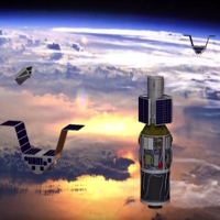
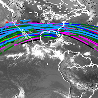
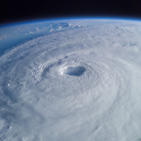
CYGNSS

Cyclone Global Navigation Satellite System

Orbit status by

SpOCK

Spacecraft Orbital Characterization Kit

SpOCK, a tool to support CYGNSS operations

Hurricane Isabel

Hurricane Tracking

Just like hurricane airplane hunters track cyclones on Earth, CYGNSS does it from space. By taking 32 wind speed measurements every second, 24 hours a day, CYGNSS significantly improves the coverage of these extreme weather events.

Learn More
CYGNSS deployment

Operations

As a constellation of 8 small satellites without any propulsion system, CYGNSS needs to be operated with passive techniques to control its trajectories. Such maneuvers are used to optimize the coverage of cyclones, and to avoid potential collisions with other objects in orbit.

Learn More
Spacecraft trajectories

Algorithm

SpOCK is used in the CYGNSS mission to predict the satellite trajectories and the locations of wind speed measurements. Using SpOCK, the CYGNSS team can forecast when CYGNSS measures winds in cyclones and analyze its orbits for maneuvering and collision avoidance purposes.

Learn More

Live Tracking

CYGNSS satellite trajectories of the current orbit.
CYGNSS wind measurement locations for the current orbit.
SIFT Live